There are some routes I walk and run very often, and some I’ve never been along, and sometimes these places are right next to each other. This was a walk along a stretch of the River Wharfe which I’ve never explored before, despite walking basically all around this area otherwise.
The walk was between the villages of Burnsall and Appletreewick, and then a bit beyond the latter. I started from Burnsall, which has a little carpark by the river on the side where most of the village is. From there, I went up to and crossed Burnsall Bridge.
On the other side, I continued along the road until I reached a gate on my right which leads into a field that is sometimes used as a carpark. It wasn’t open for that today; it’s mostly a summer thing, when people can park up and spend the day by the river.
But even when it’s not being a carpark, it’s still a field with a footpath going through it. The path is part of the Dales Way, and I would be following the route of that for a lot of the walk.
I turned into the field and walked leftwards across, on what started as a very vague path, but became a built one as it went behind some trees and through a gate.
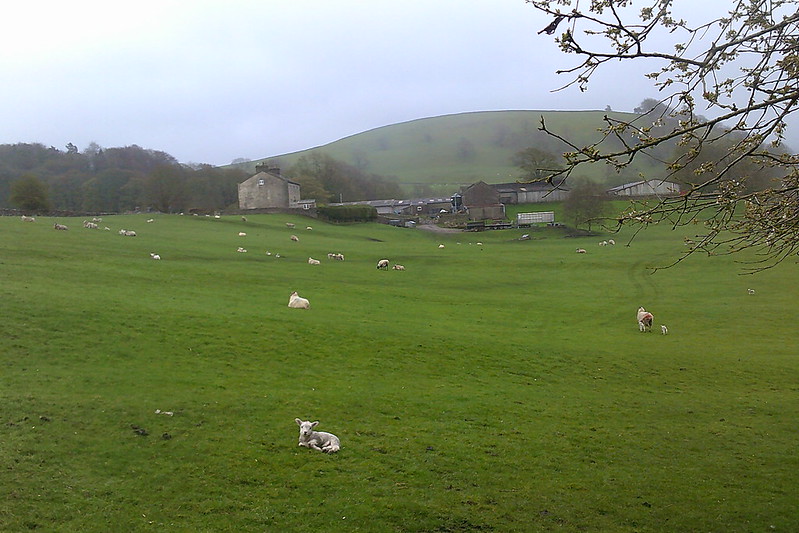
On the other side, it was a bit muddier, and going between two fences. On my right side were trees on a slope going down to the river, and on the left a big field of sheep and lambs. I saw a lot of lambs on this walk, which made an already nice day even better.
The path brought me down closer to the riverside and eventually over a stile, and onto a wider, worn-in track between two little fenced off fields.
I crossed a bridge, then continued forwards onto Woodhouse Lane. It took me through a property – house on one side of me, other building on the other – then a small field, and a gate by a barn.
Then the lane narrowed into a path which brought me back to the riverside, where it turned left and took me through another gate. Shortly after this, I came across a tree stump that had been made into a little chair, and also become a money tree. It’s not the first money tree chair I’ve seen, but they’re always fun.
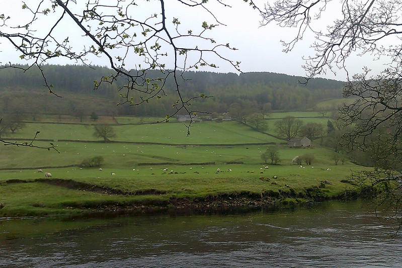
I stuck by the riverside for quite some time now. At some parts, the path was right by the water, others it came away a little. I went through gates and under trees, and after a bit came alongside a campsite near the village of Appletreewick.
I like to describe my walks in some detail, but there’s only so much I can do when it’s as straightforward as following a river.
This specific bit of the Wharfe I was actually a little familiar with, since I stayed at the campsite for a couple of nights a few years back. Just after the campsite, a path led up to the road, but I stayed by the river, going up some steps and into a field.
Still sticking by the riverside, I crossed this field, then went up another, pretty big, set of steps. Then it was along the bottom of another field, across a little plank bridge and through another gate, and onwards until I eventually came into a wooded area.
Then it was through there for a while. There was another bridge/gate combo, and a spot where I could get a good look at the river, which was flowing fast and strong on this stretch.
I came out of the woodland through a gate, went through a field and another gate, then under some more trees. I’d come away from the river a bit, and soon reached a road called Stangs Lane, just as it went over a little stream.
This is where I came off the Dales Way; that goes back to the river, while I turned left and walked a bit up the road. I passed a house on my left, then turned right over a stile into a field.
In the field I turned left again and headed in the direction of a hamlet called Skyreholme. I feel I was following some kind of path, though I can’t really see it on my photos. Still, it was a field that bumped and sloped, and I think I walked as levelly as I could through it. I could see a beck – Fir Beck, according to GoogleMaps – well below me.
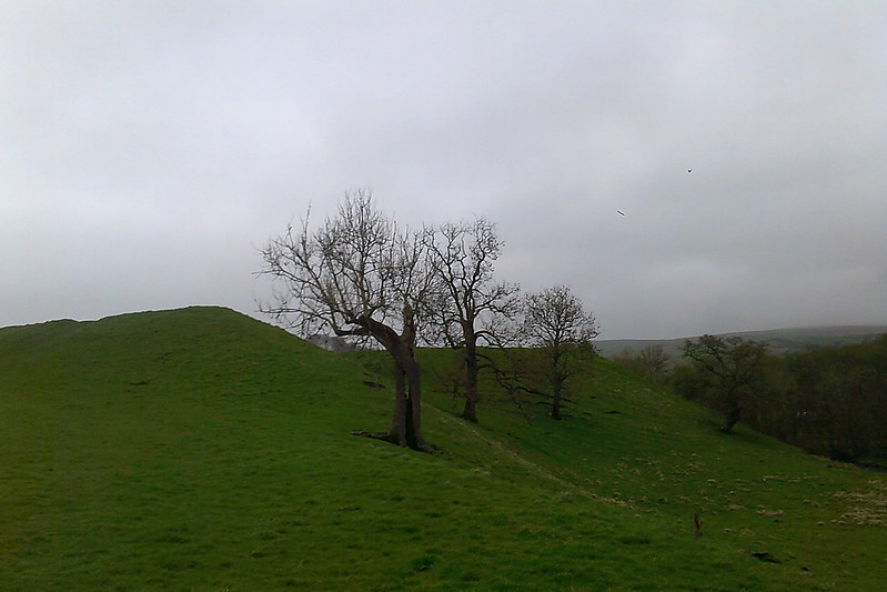
I passed an old barn on my left, then came alongside a fence on my right, on the other side of which the slope had become earthy and steep enough to count as a drop. Without the fence, someone could probably slip and fall down it.
I continued forwards along the fence, and came into sight of a caravan park ahead of me. I went through a stile onto the road which leads down to it, turned left, and walked up to Skyreholme Lane.
I had considered walking as far as Skyreholme, but rain was starting to threaten, so I decided it would be unwise to continue outwards. And in the end, I did manage to avoid the rain.
I turned left, and quickly came to a junction with two others, where I continued forwards, on Hazler Lane. I passed another junction, this one with Stangs Lane, which I’d come off earlier, and again carried on forwards.
I came into Appletreewick on the main road, and followed it through the village. After the houses end there’s a pub, then another one further along, beside the village stocks. Then the road took me down, past a couple of farms – or possible one with the buildings just spread out – and reached the campsite.
Just before the campsite a path led down to the riverside – I mentioned it earlier in the post – and I went down here and turned right.
Now I was back on the route I’d come out along, and I walked the same way back to Burnsall. Some more lambs had been born in the first field I passed on the way out in the time I’d been gone; their mother was cleaning them as I passed by.
And then I got back to Burnsall, pleased to have seen a different stretch of the River Wharfe to usual.
Photos from the walk are here. Thank you for visiting my blog.
